
5,571 farm fire alerts, 1,536 FIRs: Why satellite detections don’t translate into police action
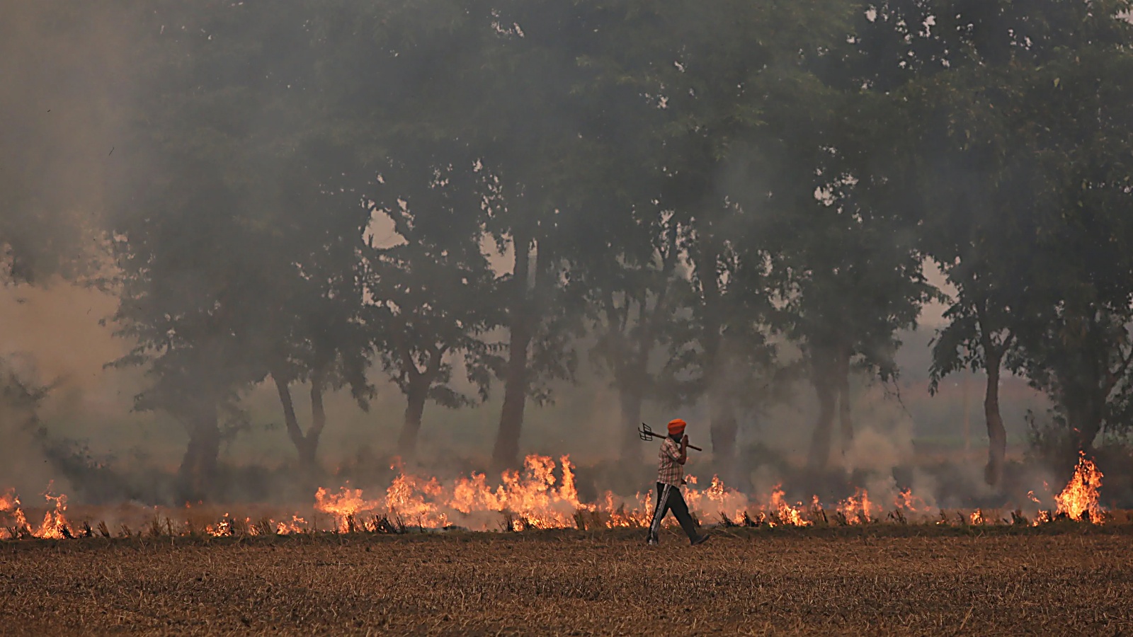
10962718 punjab stubble burning
- ✓10962718 punjab stubble burning
- ✓From September 15 to November 12, Punjab has recorded 5,571 stubble burning incidents.
- ✓However, the number of FIRs registered in the same period was nearly one fourth or only 1,536.
- ✓Crop burning was verified physically at 2,176 locations.
From September 15 to November 12, Punjab has recorded 5,571 stubble burning incidents. However, the number of FIRs registered in the same period was nearly one fourth or only 1,536. The less number of FIRs does not simply reflect a failure to act on satellite alerts, but there are a lot of factors involved.
Officials involved in the enforcement process say each fire incident reported through satellite goes through field inspection and physical verification of the stubble fire, and subsequent action depends on whether burning is confirmed, the person responsible can be identified and the prescribed procedure is followed.
According to the latest figures compiled by the Commission for Air Quality Management (CAQM), physical inspections have been conducted at 5,089 of the 5,571 satellite-reported locations. Crop burning was verified physically at 2,176 locations.
The state has registered 1,536 FIRs, accounting for approximately 27.6 per cent of the satellite-reported incidents. The figures also include 1,769 red entries in farm records and environmental compensation imposed in 1,884 cases.
These are separate enforcement measures, with action taken after the prescribed verification process. Interestingly, 161 additional cases of crop residue burning were detected through ground-level inspections at locations that had not initially been flagged by satellite remote sensing.
These were identified by the Parali Protection Force (PPF) and designated nodal officers during their field visits. Such cases underline that physical monitoring also plays a role beyond satellite-based detection. Officials involved in the verification process attribute the difference between satellite alerts and subsequent enforcement action to several factors, including inaccuracies in satellite coordinates, instances where no stubble fire is found at the several reported location, delays in physical inspections and difficulties in establishing land ownership and identifying those responsible for burning.
“One of the major challenges is the margin of error in satellite coordinates. The location provided by satellites can deviate by 700 to 800m. Subsequently, when nodal officers reach the reported GPS coordinates, they sometimes find no evidence of burning at the spot.
In such cases, the location is revisited by verification teams to establish whether burning actually took place,” said a senior Agriculture Department officer. The officer said that where no evidence of burning is found, the concerned official is required to upload a 360-degree video of the location on the designated portal to substantiate the findings.
Under the prescribed standard operating procedure, every satellite-reported incident has to be inspected within 24 hours by authorised officials. If an incident is not inspected within this period, it is automatically considered an active field fire under the monitoring protocol.
However, where a physical inspection finds no evidence of burning, the case undergoes further verification by the authorised officials. The concerned officials submits a report to the Sub-Divisional Magistrate (SDM), supported by photographs and other evidence, explaining why no fire was found at the reported location.
This distinction is important because a satellite alert is the starting point of the verification process and does not, by itself, establish a violation warranting an FIR. Even when stubble burning is physically confirmed, identifying the person responsible can take time.
Officials point to joint land ownership, outdated revenue records and cases where the recorded landowner has died as some of the difficulties in establishing responsibility. Revenue officials have to establish the legal ownership of the land and identify the person responsible before enforcement action can be taken, said sources.
The process also explains why the numbers of FIRs, red entries and environmental compensation do not necessarily match. These are different forms of action and are not automatic consequences of every satellite alert. They follow physical verification and the identification of the circumstances and persons involved in each case.
District-wise figures show considerable variation between reported farm-fire incidents and FIRs registered. Tarn Taran has recorded the highest number of FIRs, with 312 cases against 688 reported fire incidents. Ferozepur, meanwhile, has reported the highest number of satellite-detected fires at 737, against which 303 FIRs have been registered.
Patiala has registered 198 FIRs against 380 reported incidents, while Sangrur has recorded 156 FIRs against 640 fires. Malerkotla has reported 139 FIRs against 147 fire incidents. The figures show that the relationship between satellite-reported incidents and police cases varies from district to district.
In Malerkotla, for instance, the number of FIRs is relatively close to the number of reported incidents, while the gap is considerably wider in Sangrur and Firozpur.
- •Aspirants and citizens are advised to monitor official notices and circulars issued by Punjab & Haryana Regional Bureau (Chandigarh).
- •Verify all prescribed eligibility criteria, cutoff dates, and authenticated document requirements prior to formal submissions.
- •Track connected examination timetables, vacancy advisories, and administrative gazettes on SuchnaSetu.
| Issuing Authority | Punjab & Haryana Regional Bureau (Chandigarh) |
|---|---|
| Topic Category | TECHNOLOGY |
| Jurisdiction | PB State |
| Publication Date | 14 November 2026 |